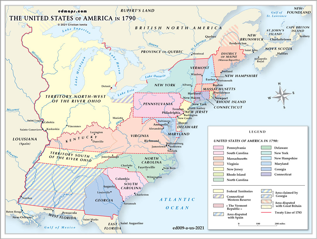
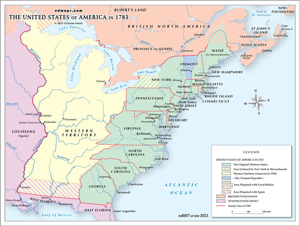
By 1790, the United States had begun to consolidate the territorial and administrative framework established after the Treaty of Paris of 1783. The new federal government, operating under the Constitution ratified in 1788, was still in its formative years, shaping institutions capable of governing a continental republic whose boundaries remained only partially defined.
The nation consisted of the original thirteen states: New Hampshire, Massachusetts (still including the District of Maine), Rhode Island, Connecticut, New York, New Jersey, Pennsylvania, Delaware, Maryland, Virginia, North Carolina, South Carolina, and Georgia. Vermont functioned as an independent republic outside the Union, and Kentucky remained part of Virginia, though its population growth and political organization were already pointing toward eventual statehood.
Beyond the settled states, the Northwest Territory formed the principal federal domain. Organized under the Northwest Ordinance of 1787, it encompassed the lands north of the Ohio River and east of the Mississippi, including the future states of Ohio, Indiana, Illinois, Michigan, Wisconsin, and part of Minnesota. Arthur St. Clair, appointed as territorial governor, oversaw the early stages of administration from the initial center at Marietta, though American control remained limited to a few settlements along the Ohio River.
In the South, North Carolina’s western lands had only recently been ceded to the federal government, forming the Territory South of the River Ohio in 1790. This region, later known as the Southwest Territory, covered the area of present‑day Tennessee. Its legal and social structure differed from that of the Northwest Territory, particularly regarding the continued legality of slavery, reflecting the sectional diversity already shaping American expansion.
Despite the new constitutional framework, several territorial uncertainties persisted. Georgia maintained expansive claims to lands stretching westward toward the Mississippi, while the northern boundary with British Canada remained imprecise in several sectors. Spanish control of Florida and Louisiana continued to complicate the southern and western frontiers, especially regarding navigation rights on the Mississippi River.
Indigenous nations retained control over vast areas of the interior. In the Ohio Valley, the Great Lakes region, the Southeast, and the trans‑Appalachian West, Native polities exercised effective authority, often resisting American settlement and federal land policies. The legal claims of the United States thus contrasted sharply with the on‑the‑ground reality of 1790, when much of the interior remained beyond American control.