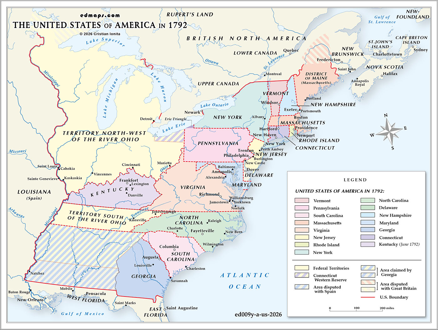
By 1792, the United States was continuing its early phase of territorial expansion and institutional consolidation under the Constitution. The federal system, still relatively new, was being tested by the incorporation of new regions and by the challenge of governing a republic whose population and settlement patterns were rapidly pushing beyond the Appalachian frontier.
The most significant development of the year was the admission of Kentucky as the fifteenth state. Formerly the western district of Virginia, Kentucky had grown into a populous and distinct frontier society shaped by migration from the Atlantic seaboard, trans‑Appalachian settlement, and the pressures of life along the Ohio River. Its admission marked the first expansion of the Union west of the Appalachian Mountains and demonstrated the federal government’s willingness to integrate frontier communities as full partners in the republic.
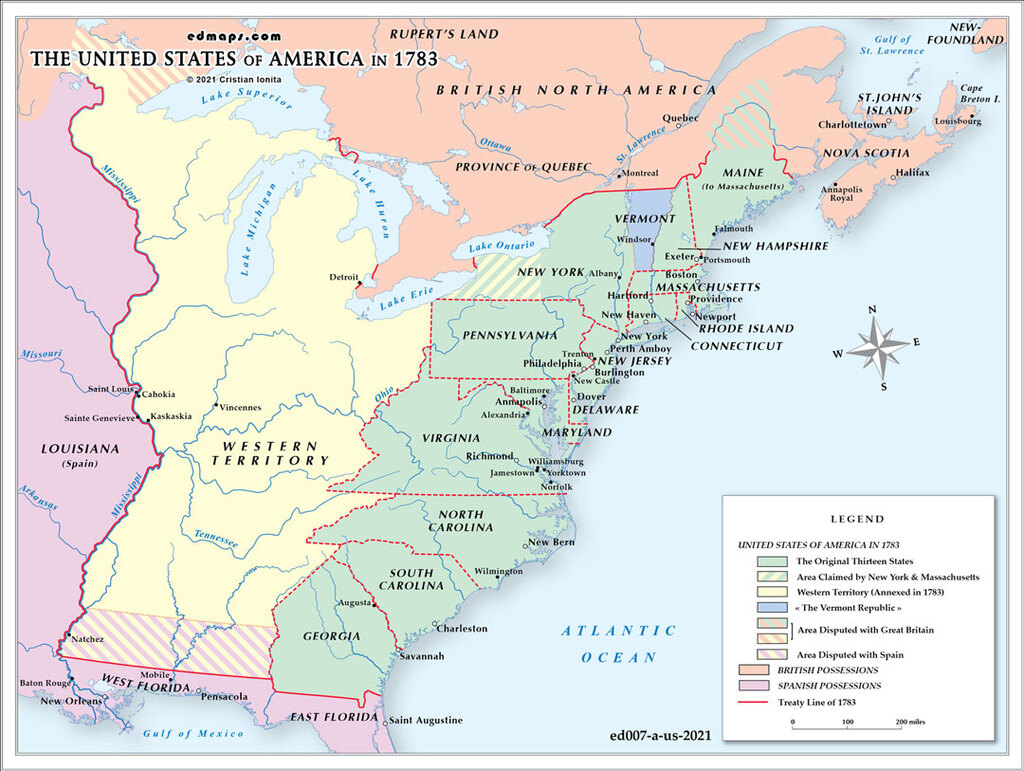
Vermont, admitted the previous year, remained the newest state in the Northeast, helping stabilize the upper Connecticut River valley and clarifying long‑standing jurisdictional disputes. Together, Vermont and Kentucky represented the first steps in transforming the United States from a coastal confederation into a continental polity.
Another important territorial adjustment of this period involved the Erie Triangle. In 1792, the federal government completed the transfer of this small but strategically valuable tract to Pennsylvania, giving the state direct access to Lake Erie. The purchase, negotiated after earlier claims by New York, Massachusetts, and Connecticut had been resolved, secured a northern outlet for Pennsylvania’s commerce and established the site where the port of Erie would later develop. Though modest in size, the annexation clarified competing colonial‑era claims and contributed to the broader process of stabilizing state boundaries in the early republic.
The federal territorial domain continued to center on the Northwest Territory, stretching north of the Ohio River toward the Great Lakes. American authority in this region remained limited, as powerful Indigenous nations controlled much of the interior and resisted U.S. settlement. Territorial administration under Governor Arthur St. Clair proceeded slowly, with only a handful of settlements established along the Ohio River corridor.
To the south, the Territory South of the River Ohio, organized in 1790 from North Carolina’s western cession, was developing under federal oversight. Its legal and social framework, including the continued legality of slavery, reflected the regional diversity already shaping American expansion. Settlement remained concentrated along river valleys and frontier stations, with much of the interior still under Indigenous control.
Boundary uncertainties persisted across the continent. Georgia continued to assert expansive claims reaching toward the Mississippi River, while Spanish control of Florida and Louisiana shaped diplomatic and commercial tensions along the southern and western frontiers. The northern boundary with British Canada remained only partially surveyed, particularly in the Great Lakes region.
In 1792, the United States thus stood at a moment of early westward growth and evolving federal authority. The admission of Kentucky, the consolidation of Vermont’s status, and the annexation of the Erie Triangle all signaled the emergence of a trans‑Appalachian republic, while the continued development of federal territories and the persistence of Indigenous power underscored the complex and contested nature of American expansion.